Yorokeikoku – Hiking in Chiba
When viewing Autumn Leaves in Japan’s busy fall season it is always a good idea to get away from the city and the tourist-heavy temples and popular sights. Outside of Tokyo there are plenty of mountain hikes where you can enjoy the deep reds and yellows of the autumn foliage while avoiding the crowds (other than the numerous Japanese seniors). A great place is Yorokeikoku (Yoro Valley) in Chiba, which is certainly worth a day-trip or a stay overnight in a local Hot Spring Inn, as long as you set out really early.
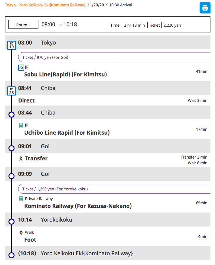
How to get to Yorokeikoku by train from Tokyo Station
Getting to Yorokeikoku Station
Traveling from the city, you will need to set out very early as sunset is at 4:30PM during November. Most Japanese are already coming back just after lunch. having set out before 9AM that morning. Head out early, especially when talking the green route (read below about walking routes).
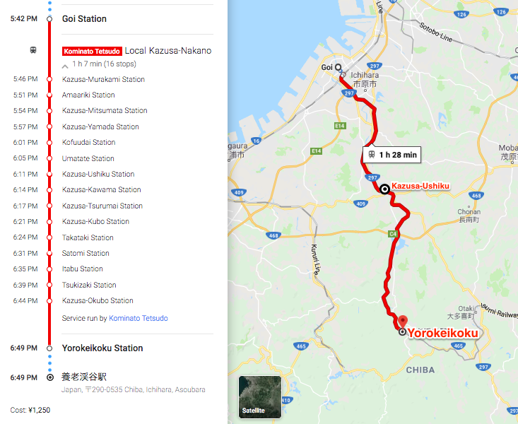
From Tokyo station you will have to change at Chiba station and again at Goi station, to then catch a private (very old fashioned) train to Yorokeikoku station. The private railway is the red line on the Google Map above. At Goi station you have to change from tracks 1/2 to tracks 3/4 and then buy a separate ticket for the Kominato Line, after you have touched out of the JR line (should you have a Suica or other card). If you have a JR pass, you don’t need to worry about touching out, however you will need to buy a ticket for the private rail line as it is not JR. They check tickets on the train.
Steam Locomotive on the Kominato Line
From Kazusa-Ushiku station to Yorokeikoku station there is a steam engine that operates a limited service during weekends. The website is in English and you can book a ticket from Kazusa-Ushiku station online. The system is in Japanese however they give you a guide on how to navigate the Japanese booking system. Bring up the booking page and the guide at the same time and you can figure it out. The result is a reservation email which you will have to substitute for a ticket on the day once you get to Kazusa-Ushiku station.
Walking the Valley
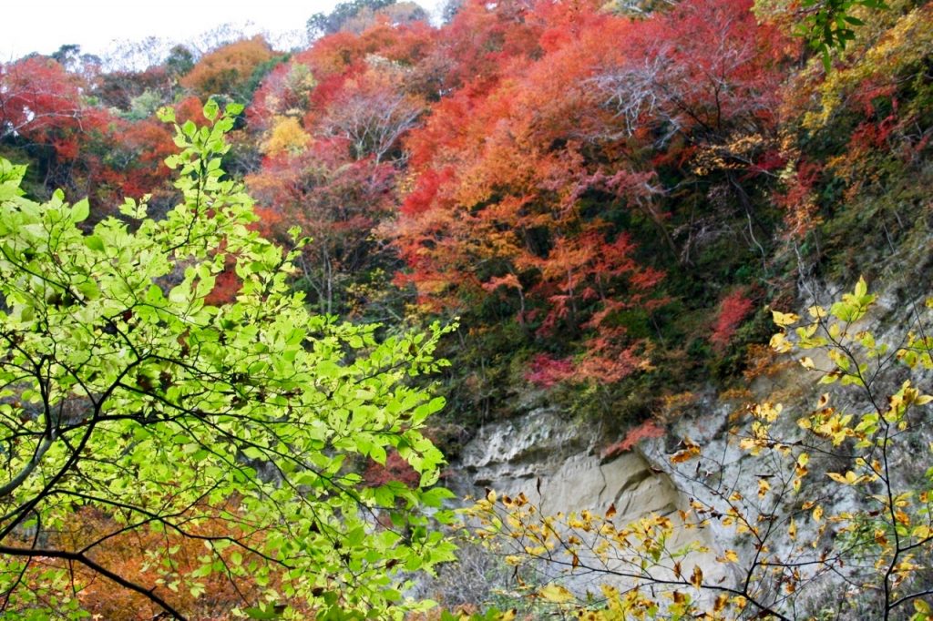
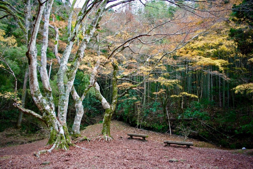
Foilage in the Valley 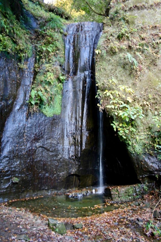
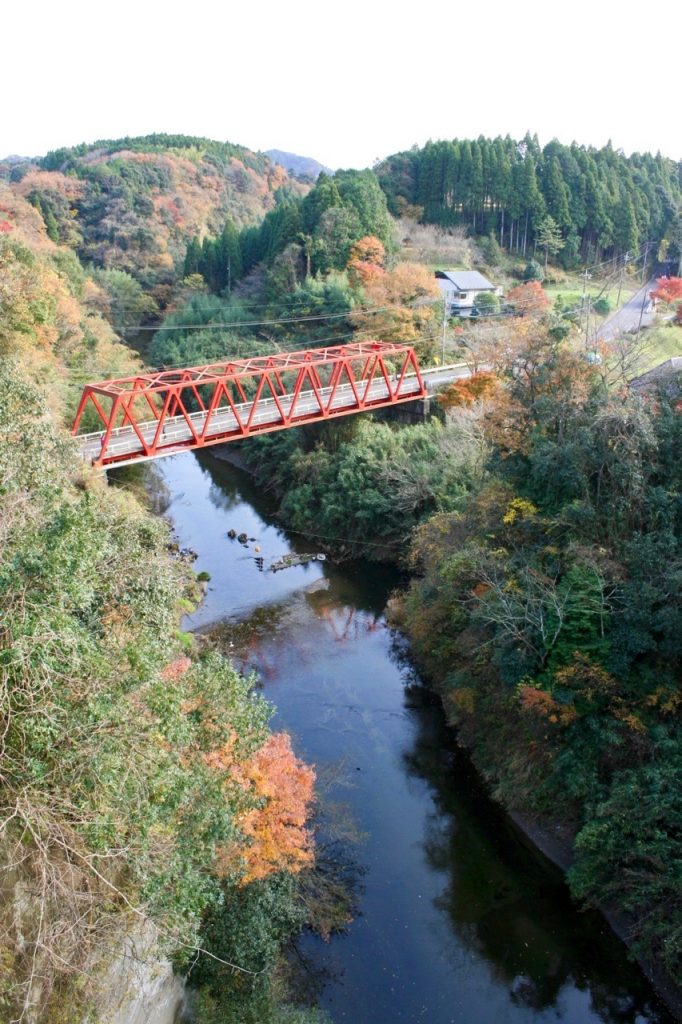
Unnamed Waterfall
Below is a map of the Yorokeikoku area from the official tourist information homepage. Click for to be taken to the homepage and PDF version. There is no English information however the red and green dotted route matches up with the circular route in the Google Map linked above. So you can follow that. These are the routes most people take. The red route is where all the restaurants and Hot Spring inns are located. However, the green route will take you to the observation tower and is the route “When Japan” took, which will take you past the secret grove, which is a spectacular site if you catch the leaves just as they are turning.
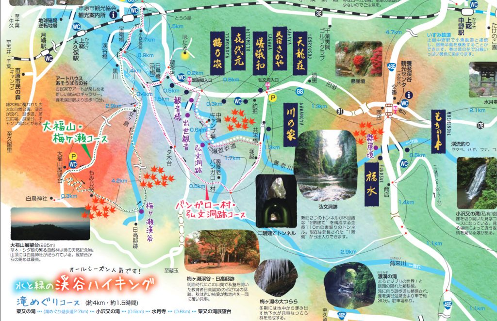
There is another map here which has similar information. The recommended routes are the green and red ones as below. Don’t worry about the Japanese on there. The routes are the same as the maps here so you can still follow without getting lost. During the peak season there are lots of Japanese out hiking so you can’t get lost.
Green Route 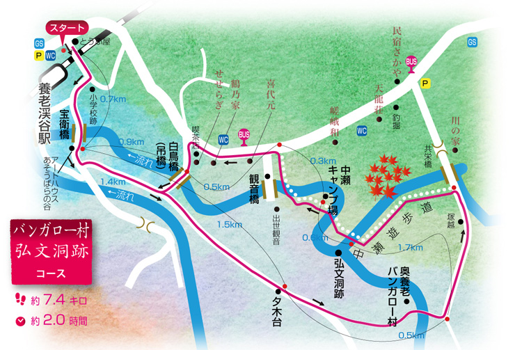
Red Route
Additional map information
In addition to the glossy tourist maps, here is a translated google map of the local area with the major places to stay, eat and visit marked (original is from the local tourist information homepage). Here is a borrowed map of the major hiking routes out of Yorokeikoku station that the majority of hikers take (the green route and the red route in the tourist maps). There is a small route further east but you need a car to get there. You can use the Google maps as a double check to make sure you don’t get lost.
Green Route
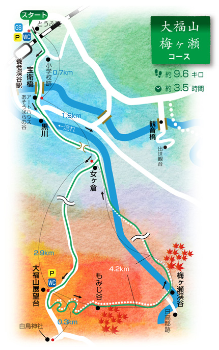
The green route will take you through part of the Umegase Valley to the Hidaka-tei, which has the picturesque living photograph that “When Japan” took a photo of a few days pasts the peak (most of the leaves had fallen already). This is what it is supposed to look like. The area is dedicated to a local man by the name of Hidaka Nobuzane, a retired army officer who lived in the area during the turn of the last century (1900s). Nobuzane set up a school that taught the locals such things as English numbers, calligraphy and Kendo and was revered enough that a monument was erected in his name so he would not be forgotten.
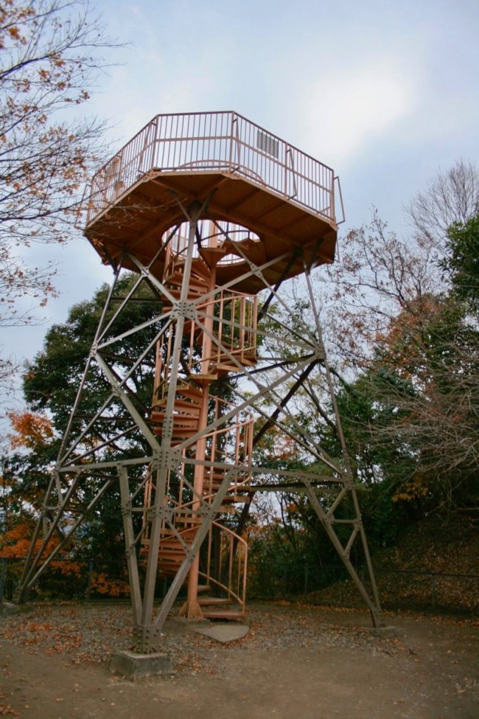
The last stop on the green route is the observation tower, which offers 360° views of the valley. However, don’t get there too late as the walk back to the station is dark and the days are short during this time of year (sunset is at 4:30PM).
Red Route
“When Japan” didn’t walk this route so has nothing to say about it. However, as there is nowhere to eat or stay along the green route, if you want to eat lunch and stay the night then the red route is your only choice.